
OFSC TRAIL REPORT
Trail Unavailable
The route is not available at this time, access is prohibited and anyone entering the property may be trespassing.
Limited Availability
Access to the identified route is limited with marginal riding opportunities, so snowmobilers enter with the understanding that they should ride with extreme care and reduced speed.
Unavailable
The identified route is not available at this time, with access prohibited, and entering any Unavailable trail on private property is trespassing.
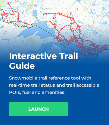
For specific trail availability details,
always consult the OFSC Interactive Trail Guide (ITG)
prior to accessing snowmobiles trails.
Sunset Trail Riders Static Trail Guides


Our Trails
Trail: A
Description: Pipeline Trail
Trail Note: NO GAS available at Stewart Lake
Distance: Kenora to Stewart Lake Est. 57 kms / 36 miles
Shelter: *See HITRAC Warm-up shelter on L102
Trail: A
Description: Kenora Town Corridor
Distance: A/A113A Jct to A/L104 Jct Est. 58 Kms / 36 miles
Shelter: N/A
Trail: A113A
Description: A/A113A Jct to Sioux Narrows
Distance: A/A113A Jct to A113A/L108 Jct (Via LOTW and Hydroline Trail) Est. 65kms/41 miles
Shelter: Witch Bay Warm-up shelter GPS Location: N 49.59720 W 94.18380
Trail: L101
Description: West Hawk Trail
Distance: L105/L101 Jct to Longpine Lake (Manitoba Border) (West Hawk Lake) Est. 50kms / 31 miles
Shelter: YamaHut Warm-up shelter (Minkaduza Lake) GPS Location: N 49.44585 W 94.54581
Trail: L102
Description: Stewart Lake Trail
Trail Note: No Gas Available at Stewart Lake
Distance: A113A/L102 Jct to A/L102 Jct Est. 54 kms/34 miles
Shelter: HiTrac Warm-up shelter (Rail Lake) GPS Location: N 49.81468 W 93.78148
Trail: L103
Description: Snook Lake Trail
Distance: L104/L103 Jct to Tomahawk & Barbie’s Warm-up shelter Est. 51 kms/32 miles
Shelter: Tomahawk & Barbie’s Warm-up shelter GPS Location: N 50.10795 W94.43923
Trail: L104
Description: Redditt Trail
Distance: A/L104 Jct to Redditt Est. 24 kms/14.9 miles
Shelter: N/A
Trail: L105
Description: McKenzie Trail
Distance: A/L105 Jct to Keewatin Est. 22 kms/14 miles
Shelter: N/A
Trail: L106M
Description: North West Angle Trail
Trail Note: Passport Required to enter USA
Distance: L101/L106M Jct to Youngs Bay (USA) Est. 61 kms / 38 miles
Shelter: N/A
Trail: L107
Description: Dogtooth Trail
Distance: A113A / L107 Jct to L102/L107 Jct Est. 33 kms/ 20 miles
Shelter: N/A
Trail: L108
Description: Dryberry Trail
Distance: L102/L108 Jct to A113A/ L108 Jct (Sioux Narrows) Est. 42 kms/ 26 miles
Shelter: Dick & Dolly’s Warm-up shelter( near Dryberry Lake) GPS Location: N 49.37105 W 93.59099
Trail: L109
Description: Longbow Trail
Distance: L107/L109 Jct to A/L109 Jct Est. 22 kms/14 miles
Shelter: N/A
Trail: L110
Description: Sunset Channel Trail
Distance: A113A/L110 Jct to L110/L106M Jct (Hydroline Trail to North West Angle Trail) Est. 54 kms / 33 miles
Shelter: N/A
Trail: L111M
Description: French Portage Narrows Trail
Trail Note: Passport required to enter the USA
Distance: L110 /L 111M Jct to Oak Island (USA) (SunsetChannel Trail to Oak Island USA) Est. 25 kms / 15 miles
Shelter: N/A
Mileage
Mileage (Starting from Kenora) is only approximate and changes from year to year based on staked trail locations.
| Destination | Kms | Miles |
|---|---|---|
| Atikokan | 430 | 267 |
| Dryden | 180 | 267 |
| Fort Frances | 300 | 186 |
| Rainy River | 175 | 108 |
| Red Lake | 350 | 217 |
| Sioux Lookout | 300 | 186 |
| Thunder Bay | 700 | 434 |
Planning On Riding Our Trails?
Please make sure to select Sunset Trail Riders as your club while purchasing your permit to help support our club!
MAY WE HAVE YOUR ATTENTION PLEASE
2025 Ontario Snowmobile Trail Permits are now available online at
https://permits.ofsc.on.ca !
You will be happy to note that there is no fee increase this season but purchasing now through November 1st is the best value for your money and fees are in effect until November 1st.*
Your permit purchase supports club volunteer efforts and investments into the provincial snowmobile trail network through groomer acquisitions and refurbishment, infrastructure maintenance and replacement, trail preparation and grooming operations.
See you on the trails this year!!
*permit terms and conditions available online at ofsc.on.ca

Trail News
No Results Found
The page you requested could not be found. Try refining your search, or use the navigation above to locate the post.
OUR SPONSORS


