
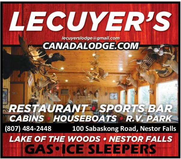
Please ensure you Buy Where You Ride
Select Sunset Trail Riders as your club
during your online permit purchase.


Are your kids trained?
Driver training courses are available in areas across Ontario.
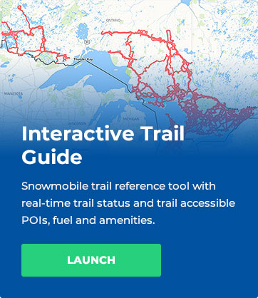
Trail Guides
Trail Report
TRAIL UNAVAILABLE
The route is not available at this time, access is prohibited and anyone entering the property may be trespassing.
LIMITED AVAILABILITY
Access to the identified route is limited with marginal riding opportunities, snowmobilers enter with the understanding that they should exercise extreme care and reduce speed.
AVAILABLE
The identified route is accessible with the understanding that the trail will likely vary considerably in quality, attributes and terrain over it’s length.
For specific trail availability details,
always consult the OFSC Interactive Trail Guide (ITG)
prior to accessing snowmobiles trails.
WEEKLY GROOMING HISTORY
(Updated Every Friday)


| TRAIL | DESCRIPTION | TRAIL NOTE | DISTANCE | SHELTER |
| A | Pipeline Trail |
NO GAS available at Stewart Lake |
Kenora To Stewart Lake Est. 57 kms / 36 miles |
*See HITRAC Warm-up shelter on L102 |
| A | Kenora Town Corridor |
A/A113A Jct to A/L104 Jct Est. 19 kms / 11.7 miles |
N/A | |
| A | Kenora to Falcon Lake (MB) |
Kenora to Falcon Lake (MB) Est. 58 kms / 36 miles |
Enns Brothers Warm-Up shelter (Rush Bay) |
|
| A113A |
A/A113A Jct to Sioux Narrows
|
A/A113A Jct to A113A/L108 Jct (Via LOTW and Hydroline Trail) Est. 65kms/41 miles |
Witch Bay Warm-up shelter GPS Location: N 49.59720 W 94.18380 |
|
| L101 | West Hawk Trail |
L105/L101 Jct to Longpine Lake (Manitoba Border) (West Hawk Lake) Est. 50kms / 31 miles |
YamaHut Warm-up shelter (Minkaduza Lake) GPS Location: N 49.44585 W 94.54581 |
|
| L102 | Stewart Lake Trail |
NO GAS available at Stewart Lake |
A113A/L102 Jct to A/L102 Jct Est. 54 kms/34 miles |
HiTrac Warm-up shelter GPS Location: |
| L103 | Snook Lake Trail |
L104/L103 Jct to Tomahawk & Barbie’s Warm-up shelter Est. 51 kms/32 miles |
Tomahawk & Barbie’s Warm-up shelter GPS Location: |
|
| L104 | Redditt Trail |
A/L104 Jct to Redditt Est. 24 kms/14.9 miles |
N/A | |
| L105 | McKenzie Trail |
A/L105 Jct to Keewatin Est. 22 kms/14 miles |
N/A | |
| L106M | North West Angle Trail |
Passport Required to enter USA |
L101/L106M Jct to Youngs Bay (USA) Est. 61 kms / 38 miles |
N/A |
| L107 | Dogtooth Trail |
A113A / L107 Jct to L102/L107 Jct Est. 33 kms/ 20 miles |
N/A | |
| L108 | Dryberry Trail |
L102/L108 Jct to A113A/ L108 Jct (Sioux Narrows) Est. 42 kms/ 26 miles |
Dick & Dolly’s Warm-up shelter( near Dryberry Lake) |
|
| L109 | Longbow Trail |
L107/L109 Jct to A/L109 Jct Est. 22 kms/14 miles |
N/A | |
| L110 | Sunset Channel Trail |
A113A/L110 Jct to L110/L106M Jct (Hydroline Trail to North West Angle Trail) Est. 54 kms / 33 miles |
||
| L111M |
French Portage Narrows Trail |
Passport required to enter USA |
L110 /L 111M Jct to Oak Island (USA) (SunsetChannel Trail to Oak Island USA) Est. 25 kms / 15 miles |
Latest News
April 2024 – Year End News
Sunset Trailriders Snowmobile Club had a very different season this year, as Mother Nature was being difficult with the snow so controlled all of our activities. Despite the conditions our dedicated volunteers still put in approximately 4000+ lake stakes and signs....
All TRAILS UNAVAILABLE
All trails are currently unavailable for snowmobiling.
Advertise with us!
Promote your business while supporting our club by advertising on our site!
Sponsorship Website Ad
Bottom of every webpage.
$300/yr
Contact [email protected] for more information.
 |
 |
 |
 |